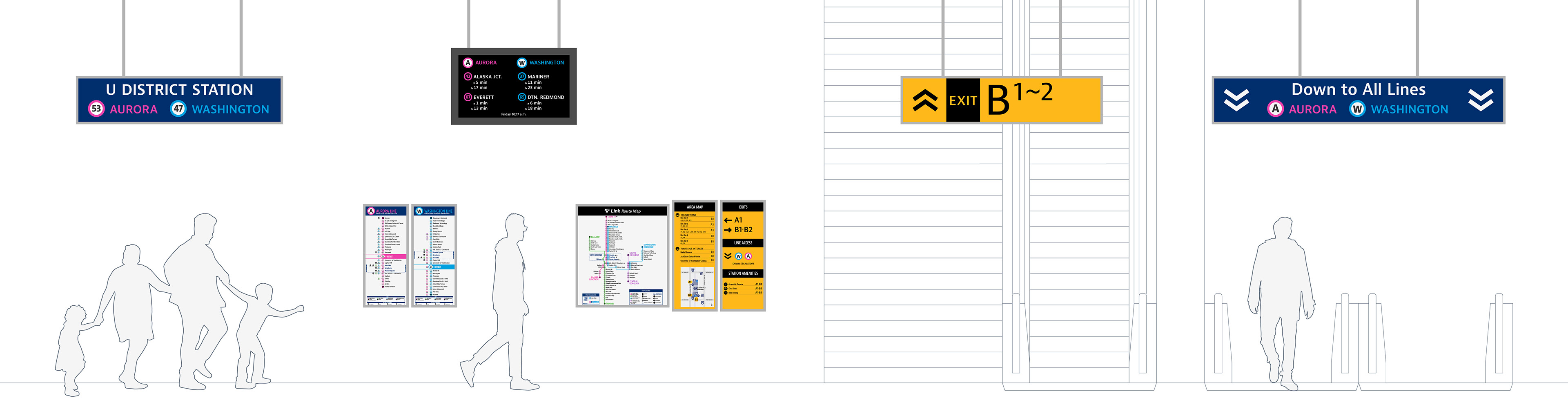

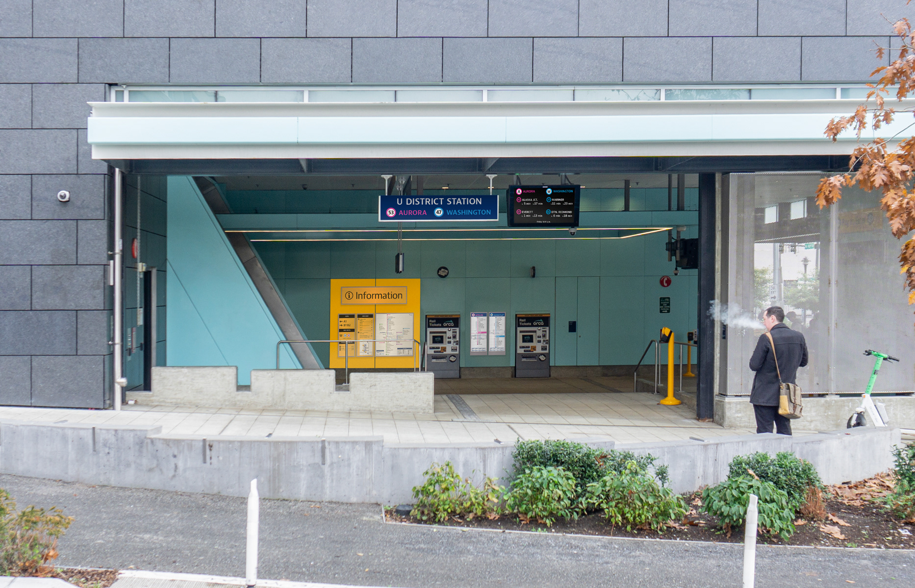
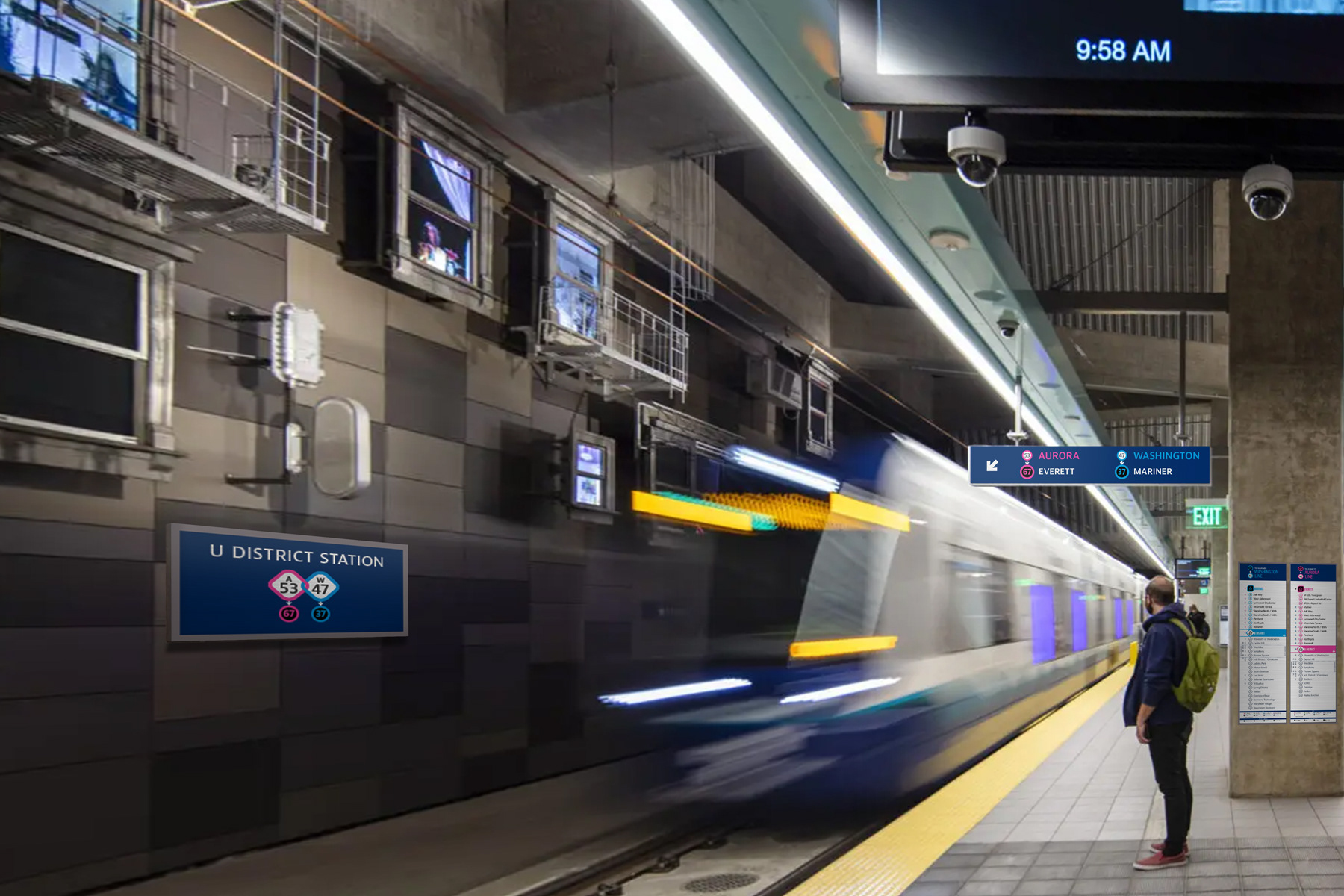
U District Station sign.

Entrance orientation signs and line maps.
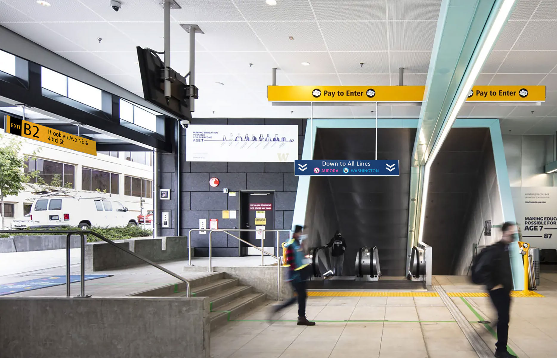
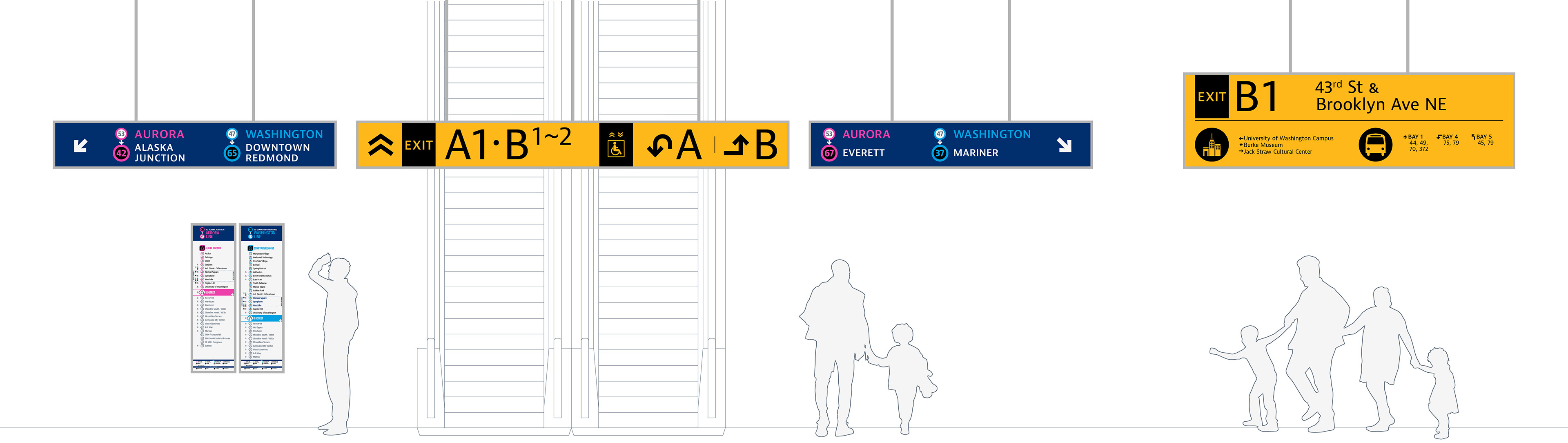
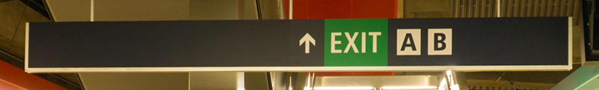
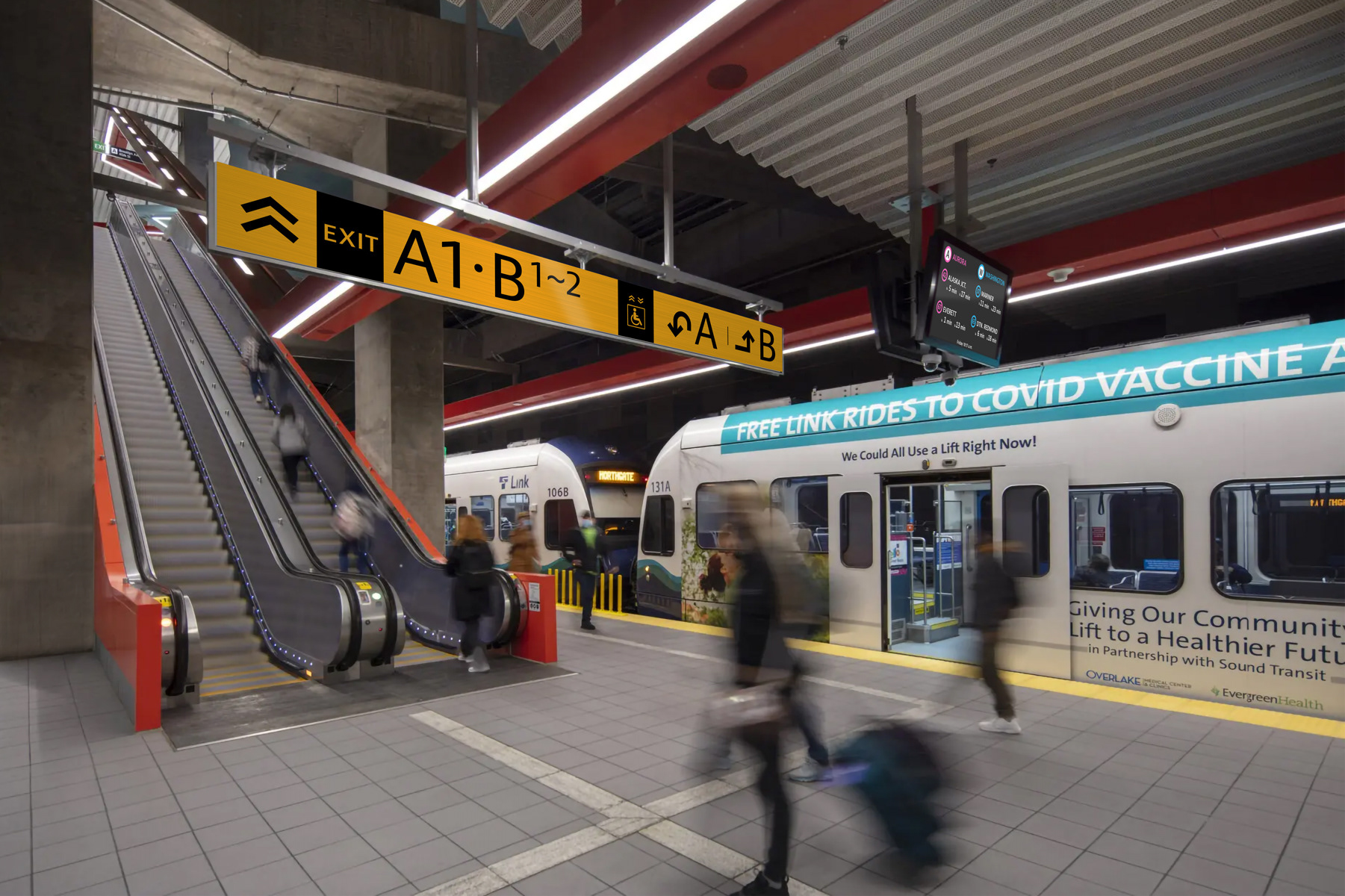
Exit sign and directional sign to lines.
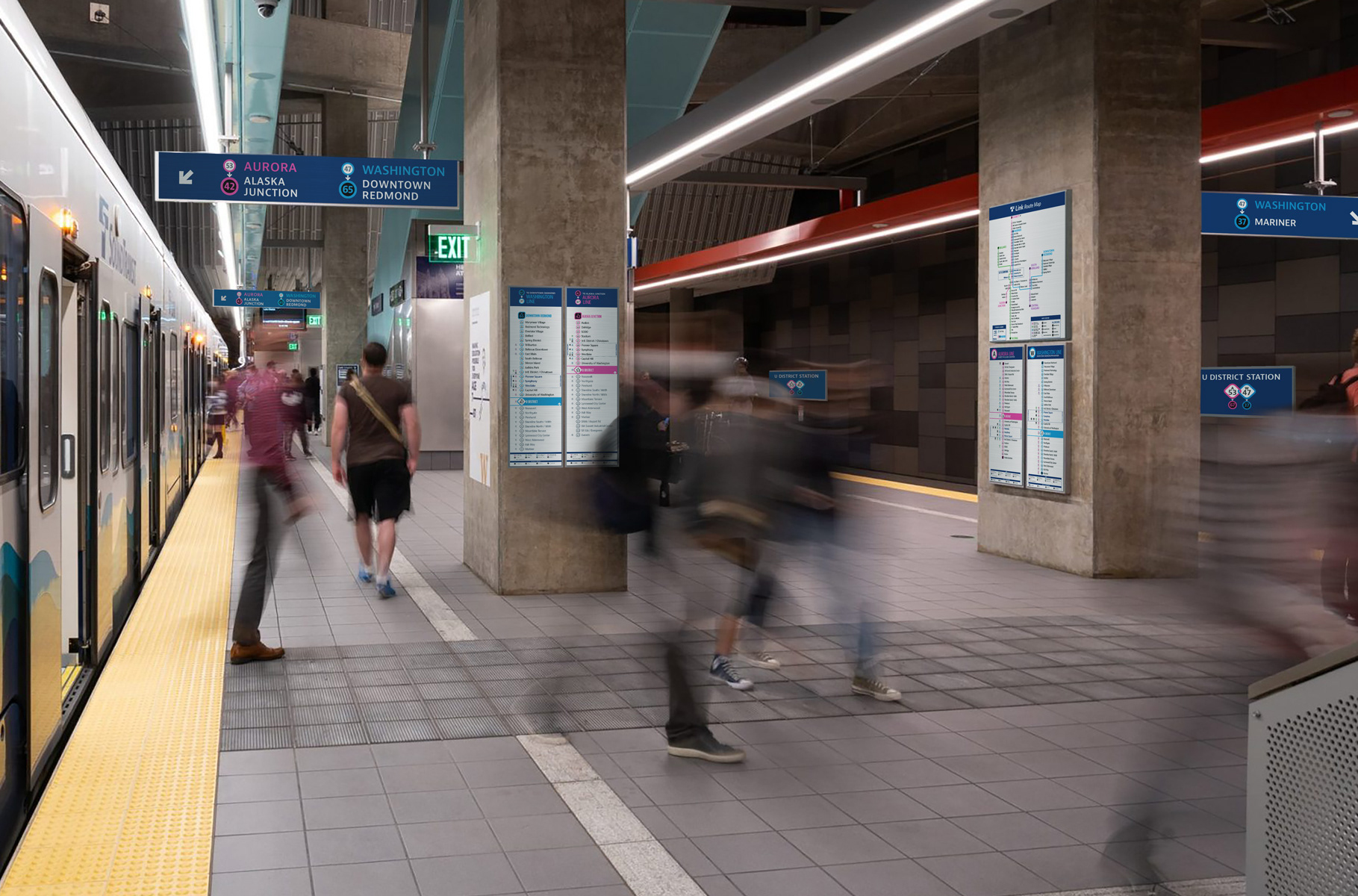
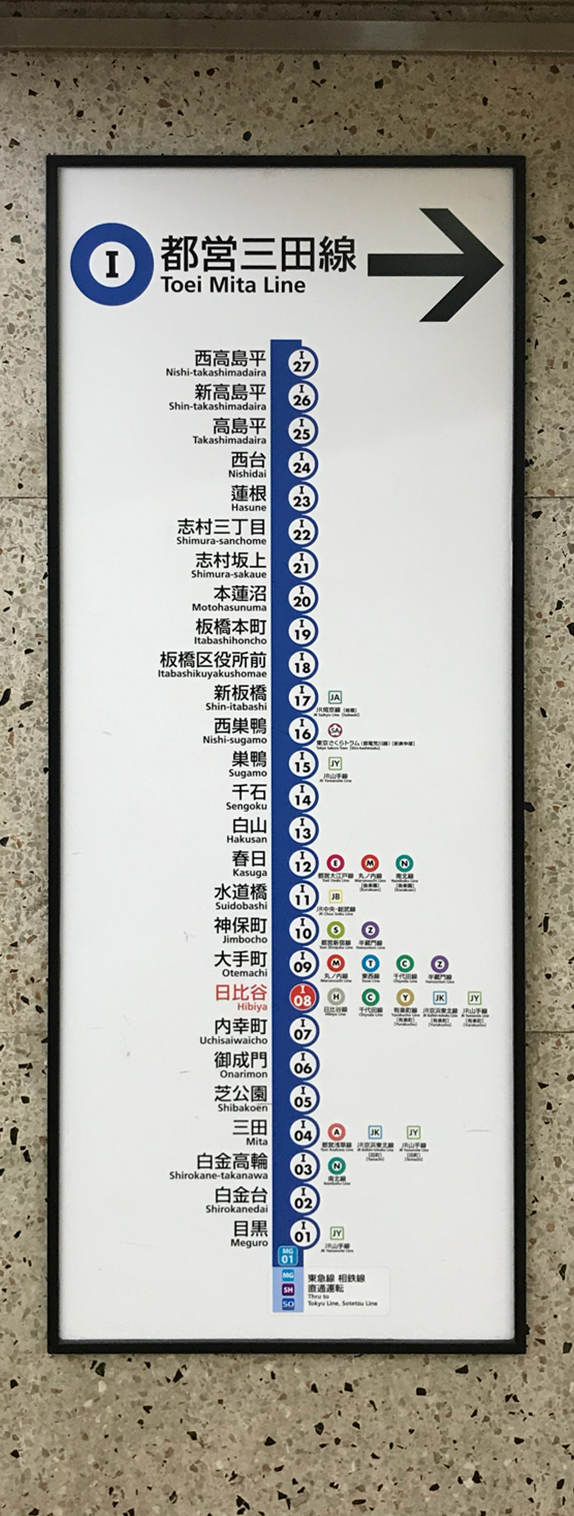
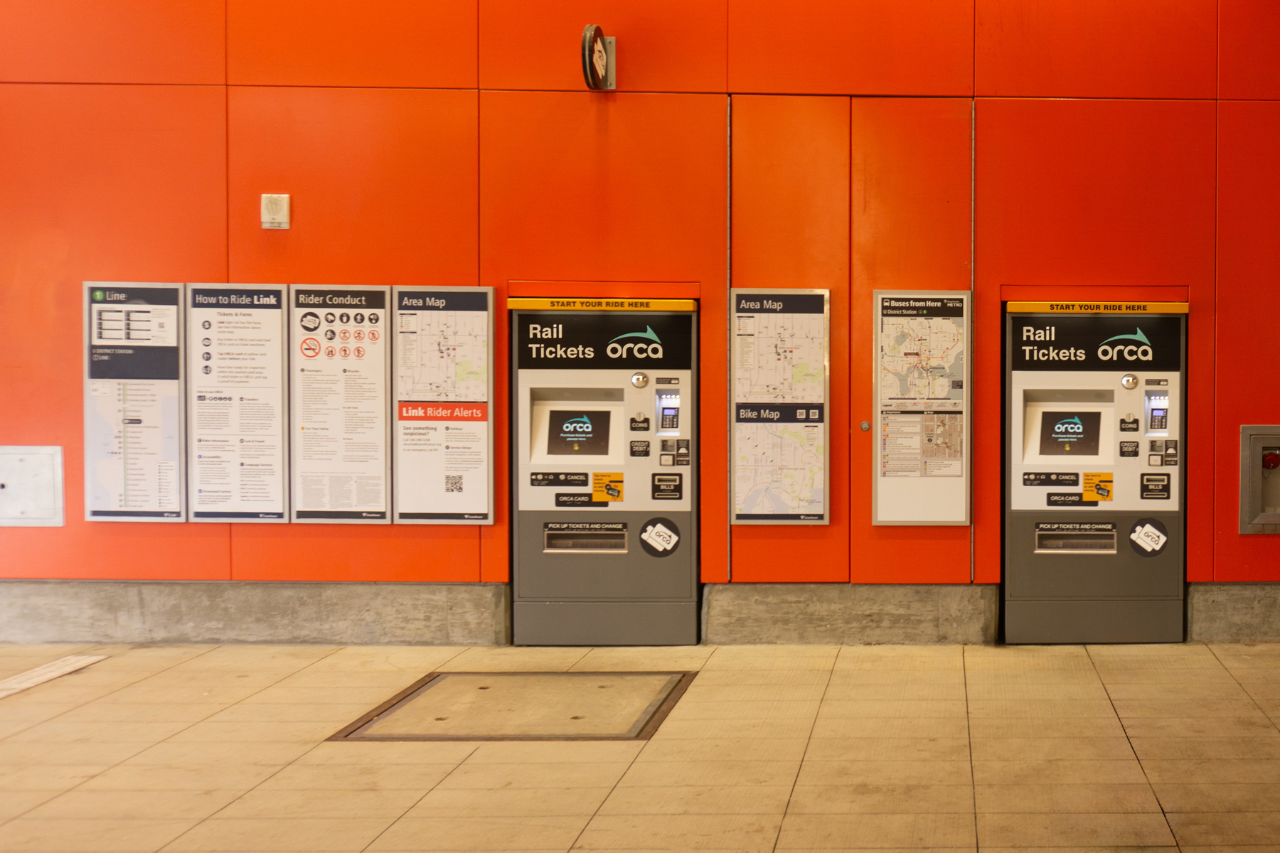
Platform identification signs and line maps.

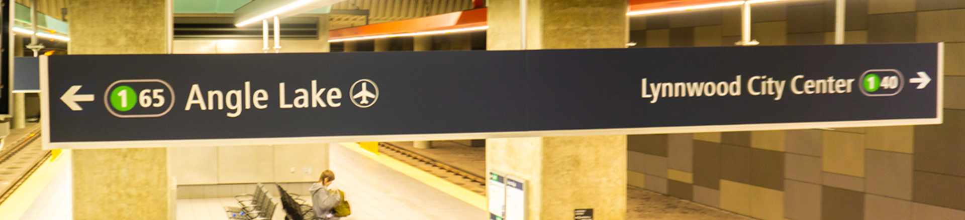
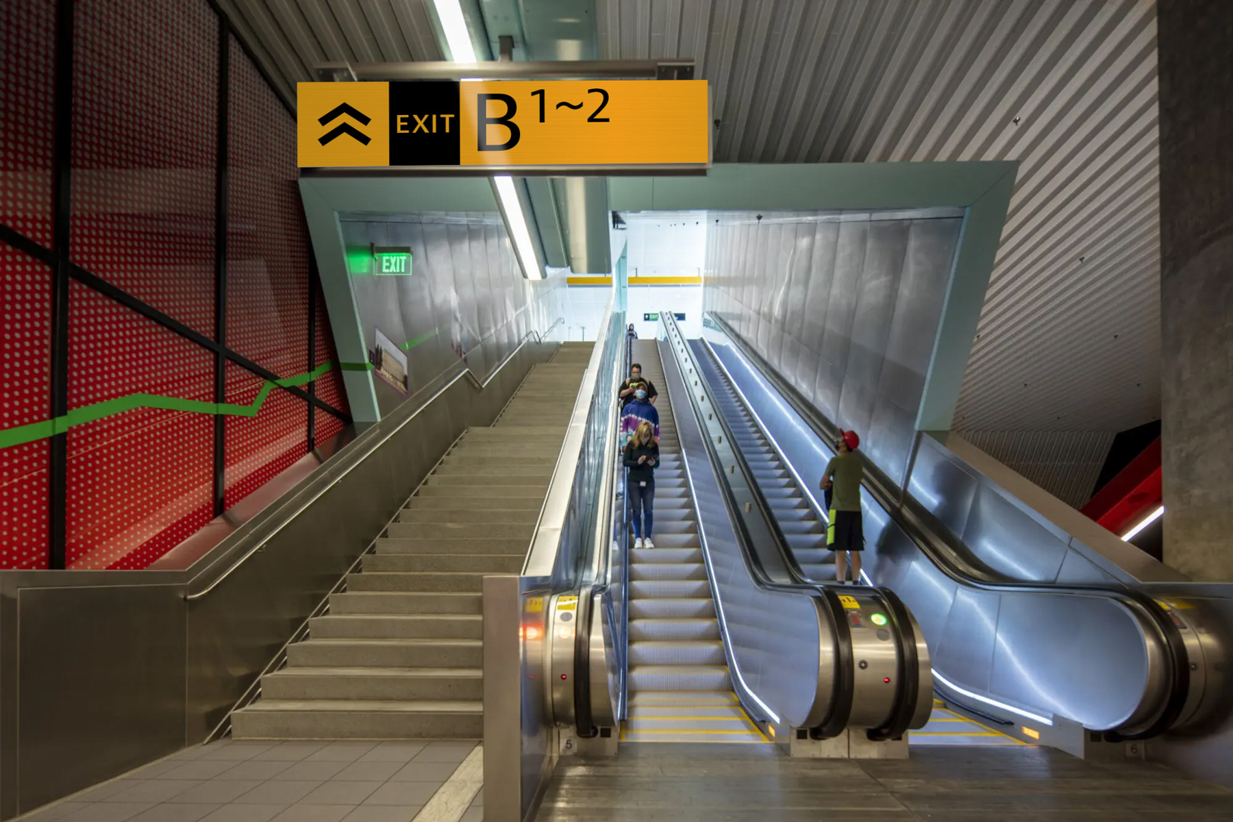
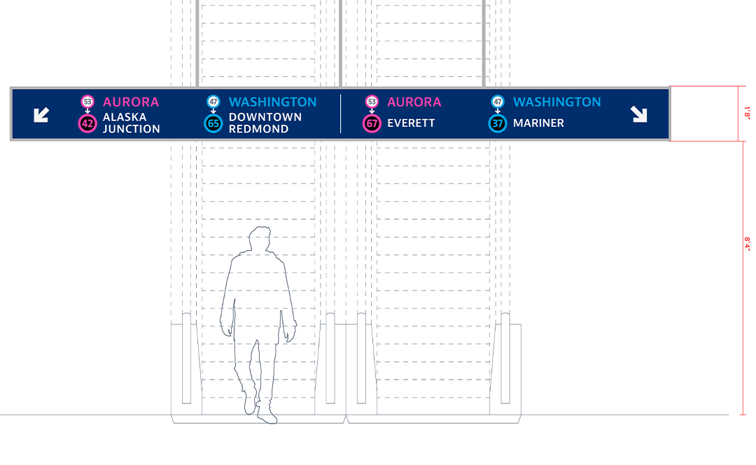
Directional exit signs on platform.
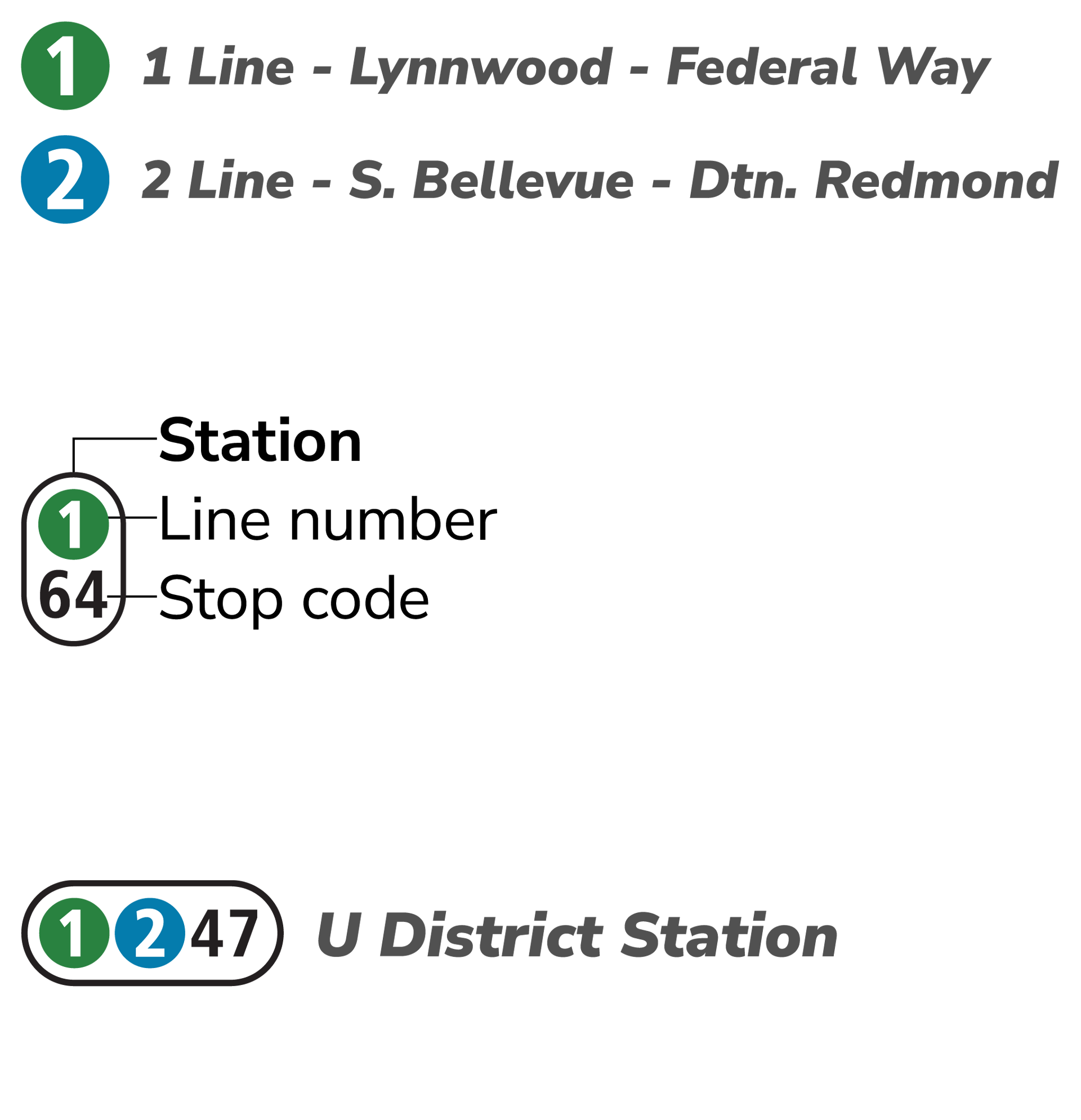
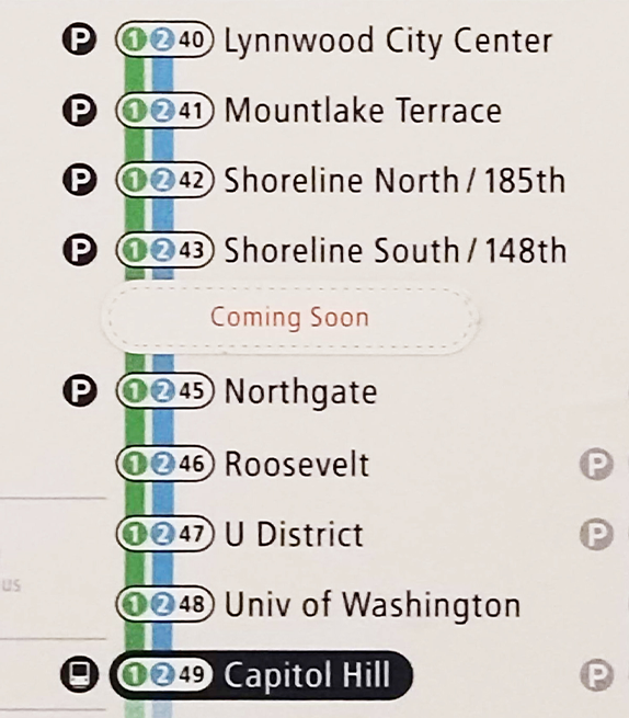
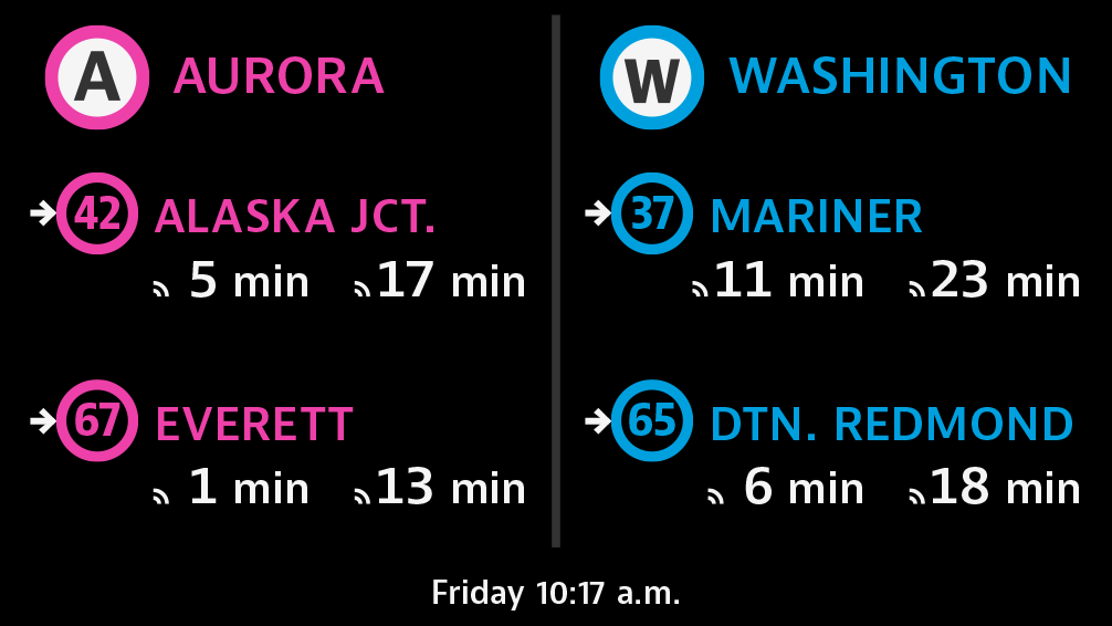
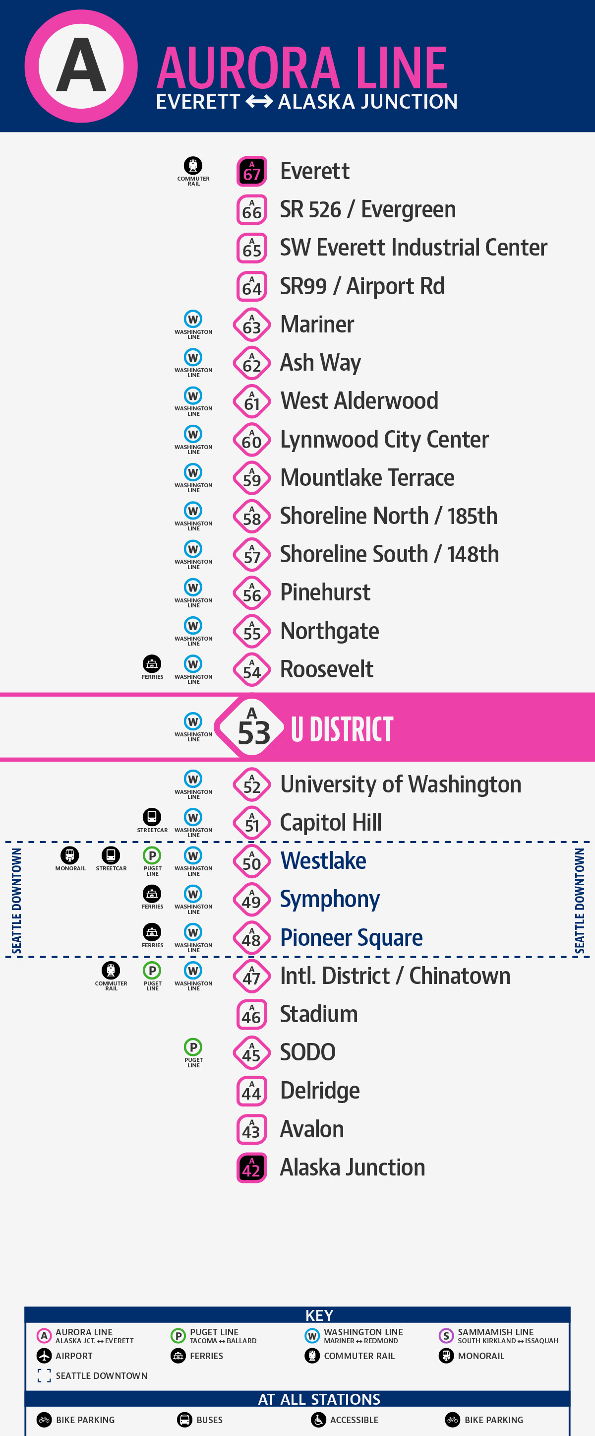
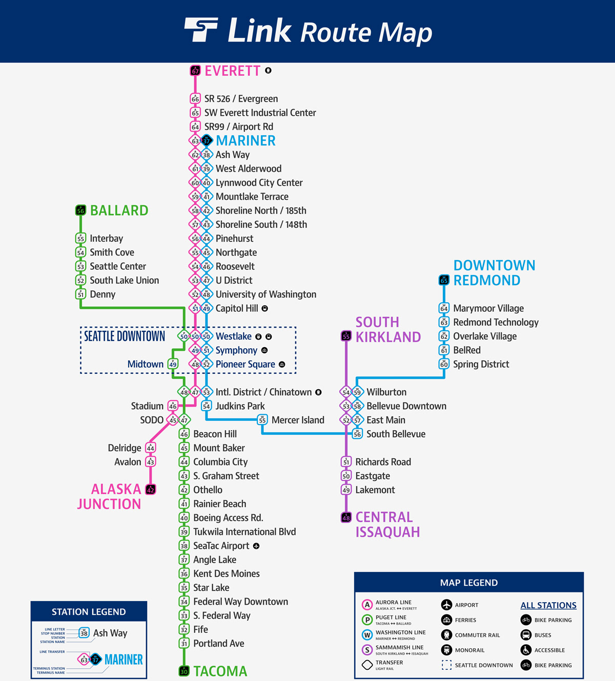
Current station listing with lines 1 & 2 starting at station #40 and sharing station numbers.
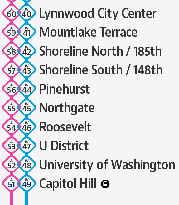
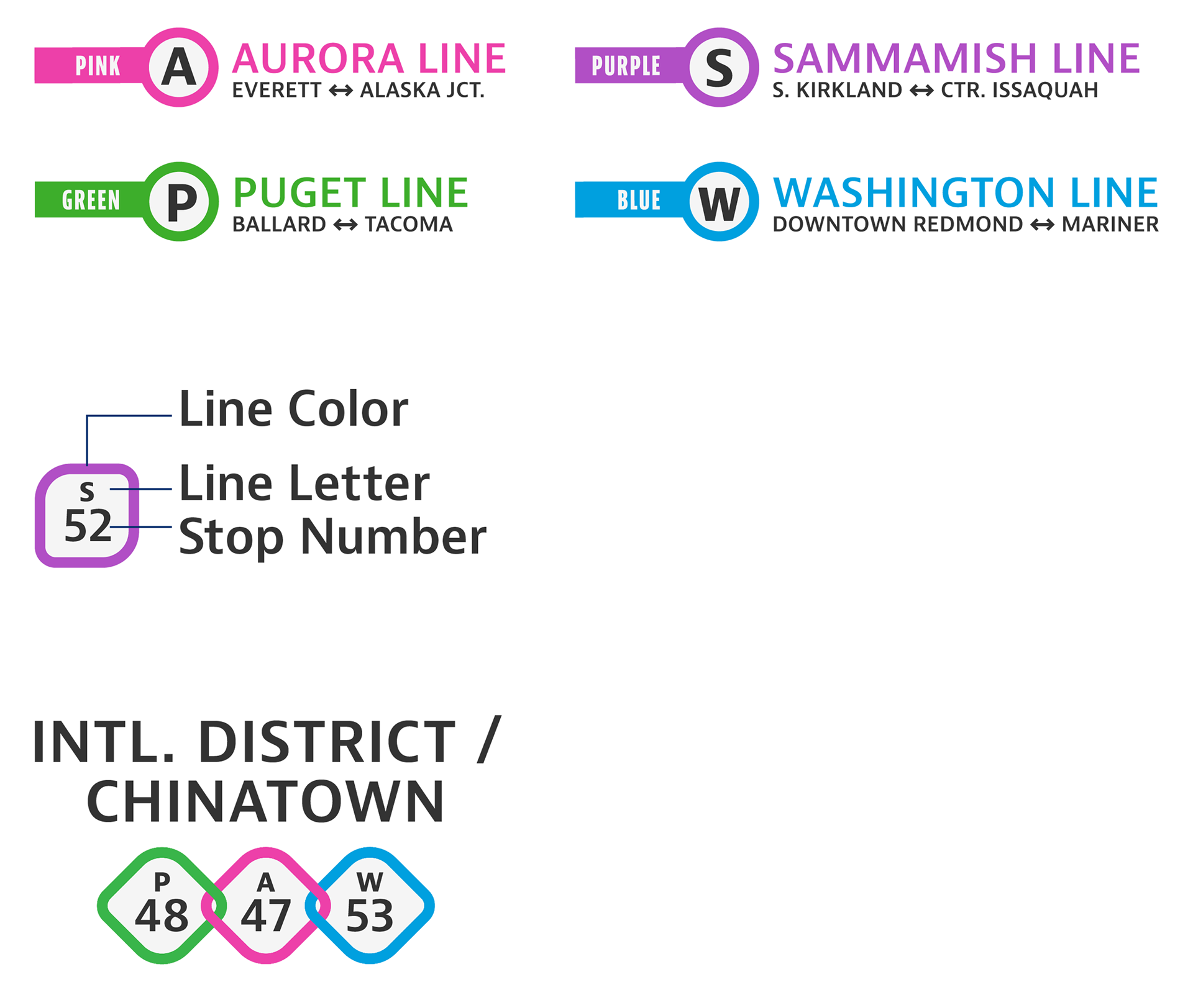
Section of full service map highlighting Seattle downtown stations and inversion of station numbers from Capitol Hill upward.
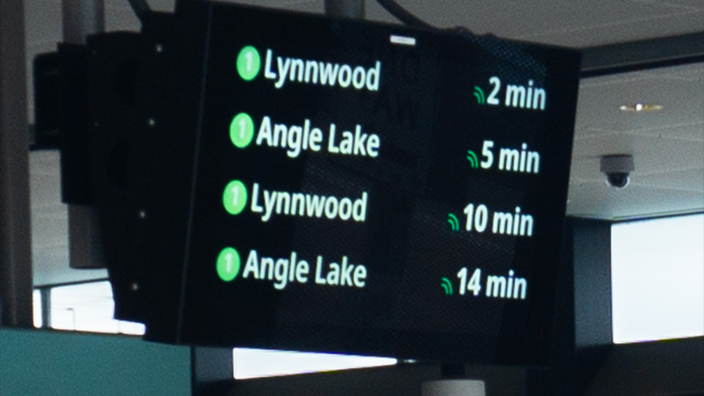
Existing Real-Time Arrival signage listing a single line traveling in two directions intermittently.
Arrivals listed by line then direction, and terminal station names are shown with stop numbers for quicker processing.
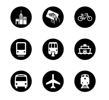
Existing Icons. Top: point of interest, Orca kiosk, bike parking. Middle: streetcar, monorail, ferry. Bottom: bus, airport, train.

Direct Movements: left, ahead, behind, right.

Compound Movements: left then first left, around the corner to your left, around the corner to your right, right then first right.
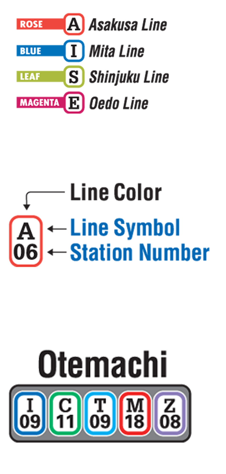
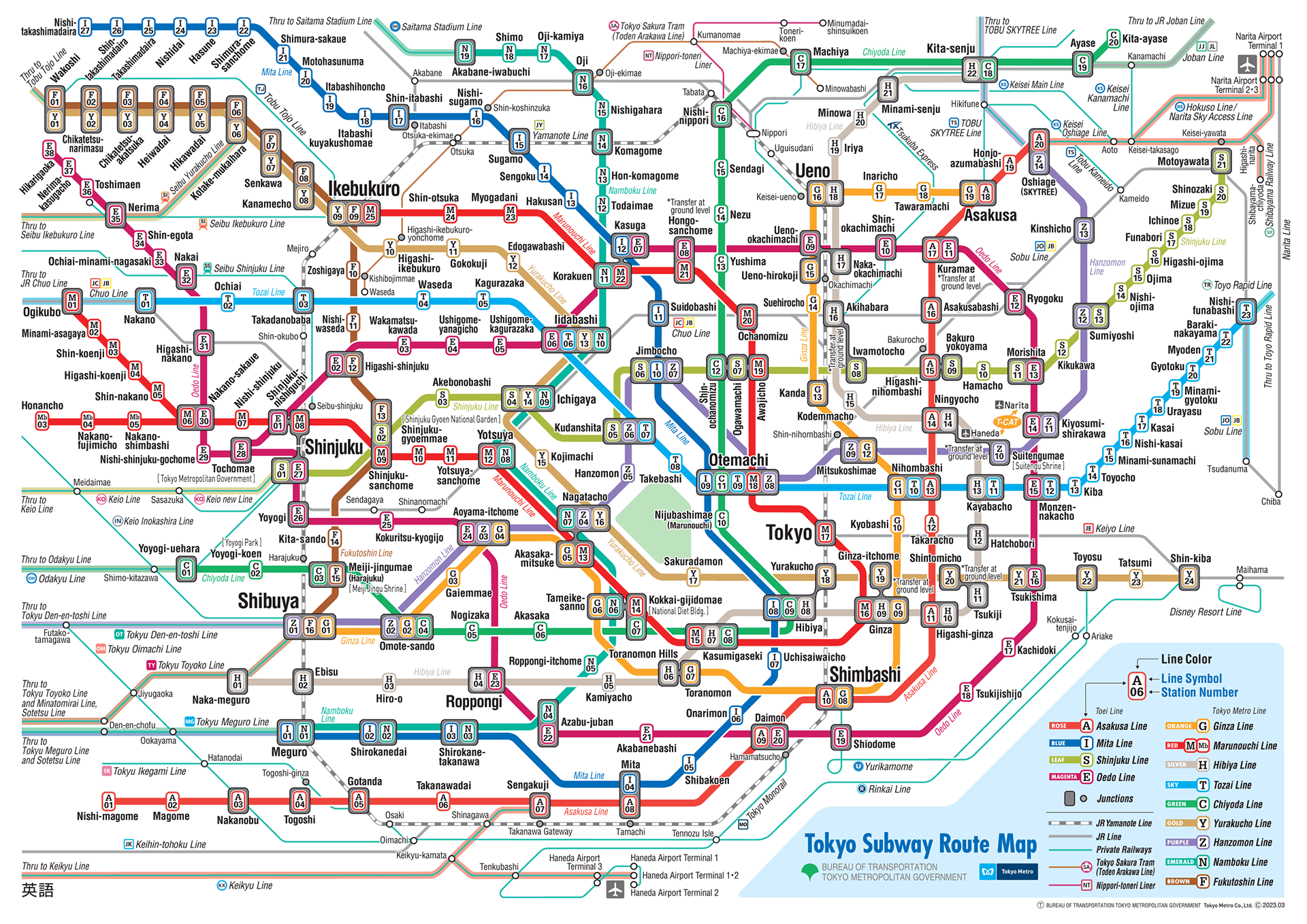
Tokyo Metro arrow icons, including going around a corner

Level Movements: ascend and descend a level

Identification Arrows: on your left, here, on your right
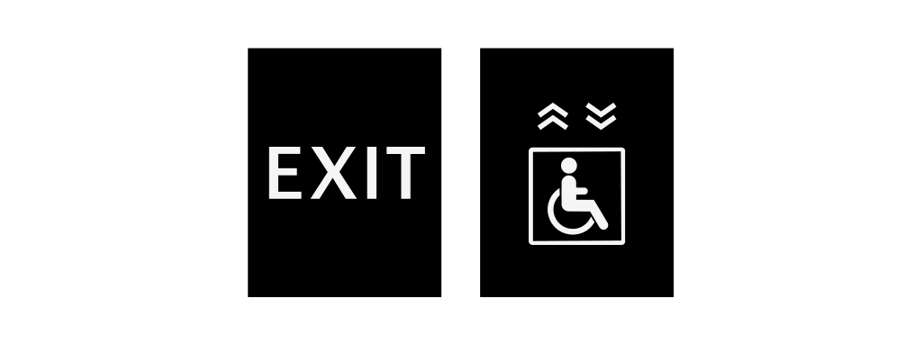
Exits: exit, accessible exit
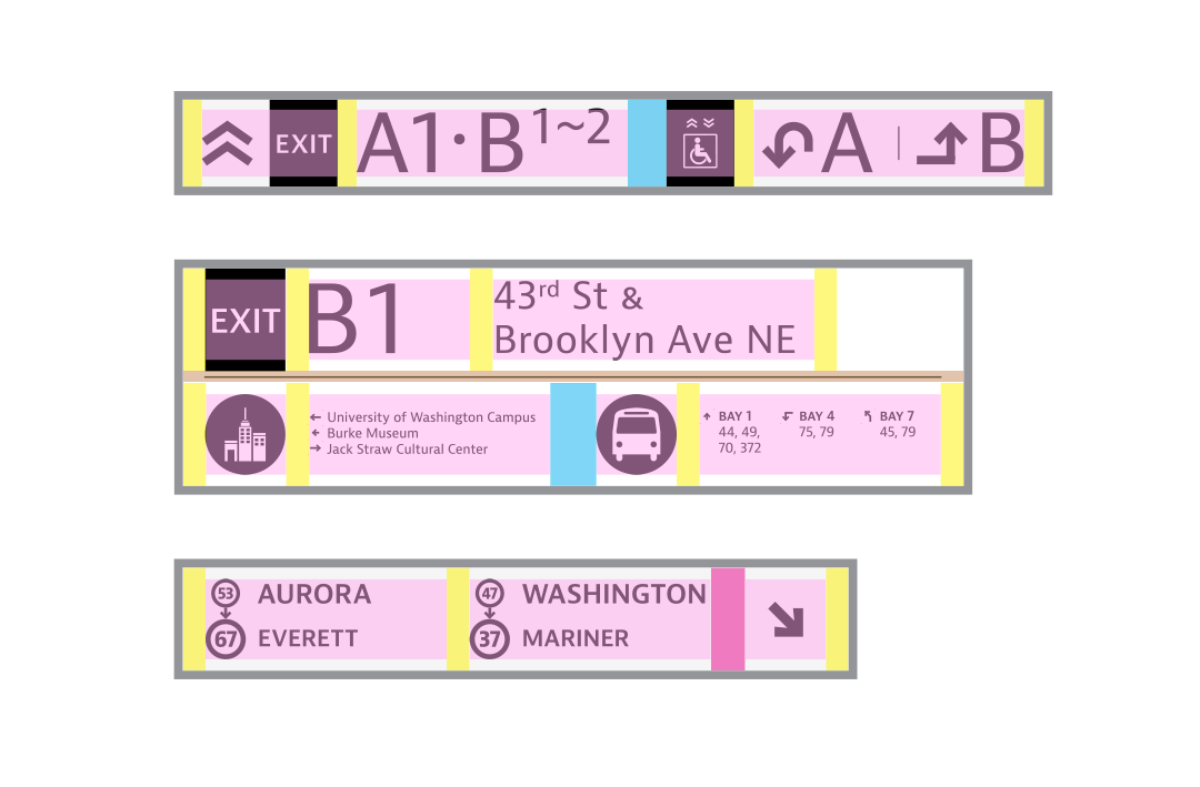
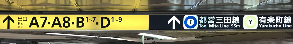
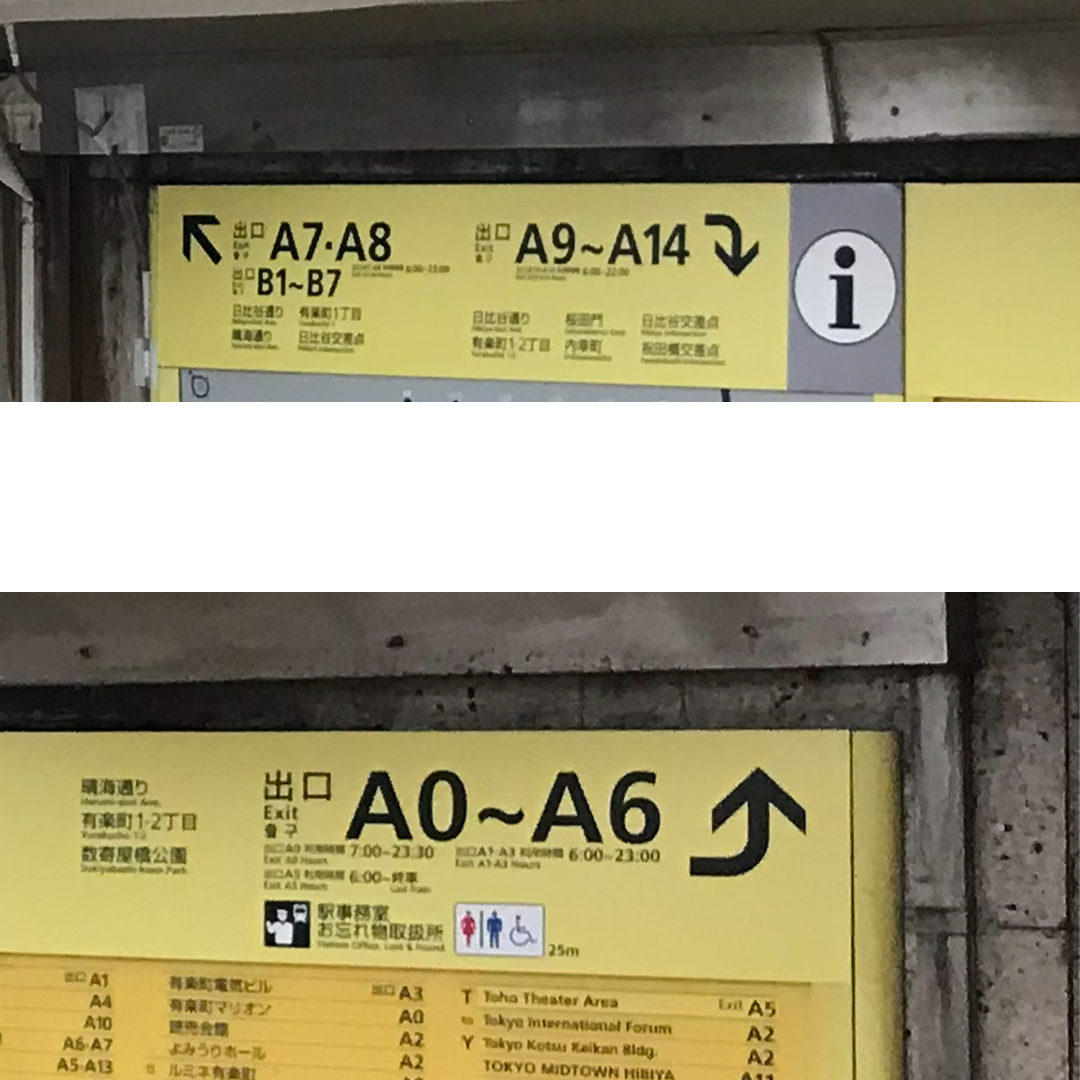
Tokyo directional signage visually separating exit directions from lines.
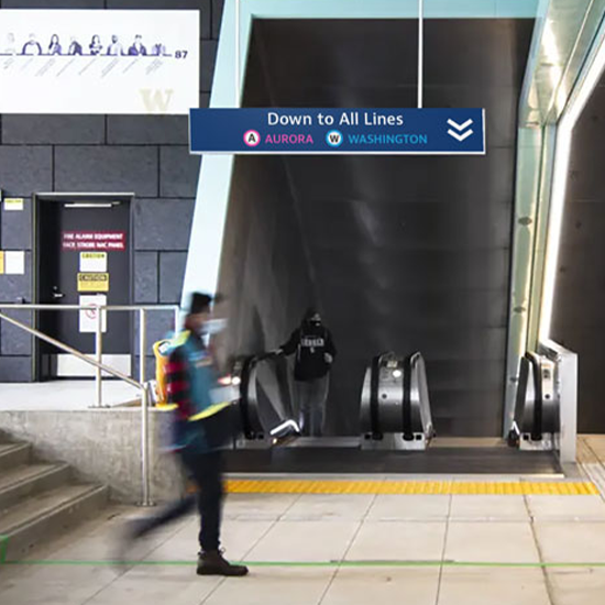
Existing exit directional sign.
Existing identification sign.
Existing orientation signs located at Link station entrance.

Tokyo orientation sign with points of interest and area map.
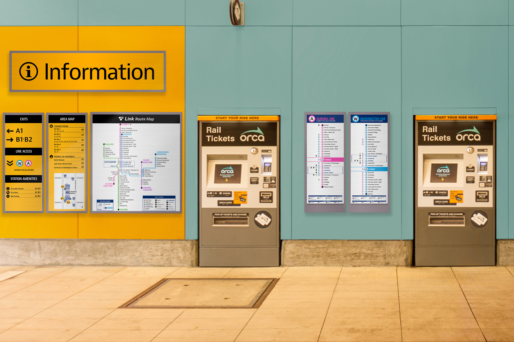
Station entrance orientation information hub. Displays lines serviced by the station, nearby points of interest, and full service map.
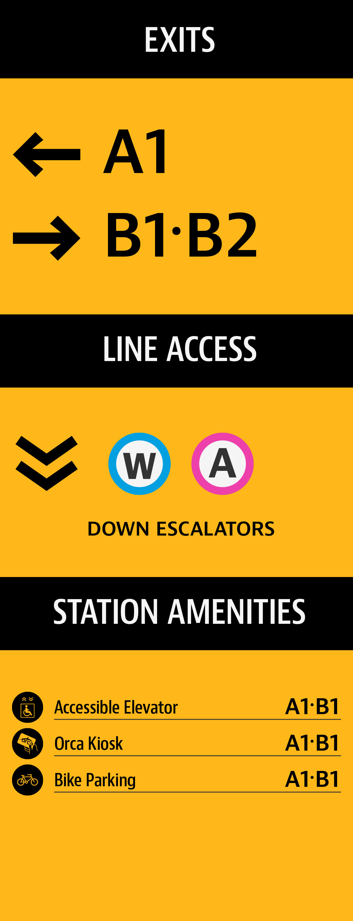
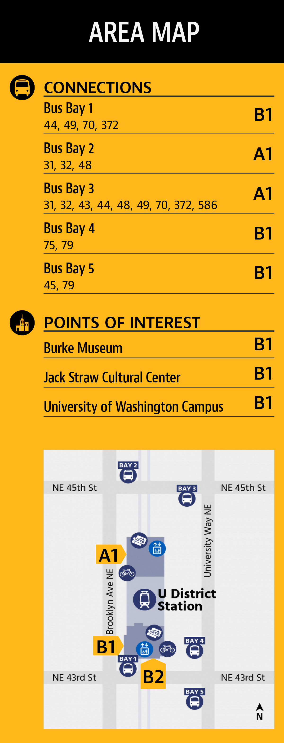
Orientation panels listing points of interest and bus connections by categories to make finding correct exits easier.
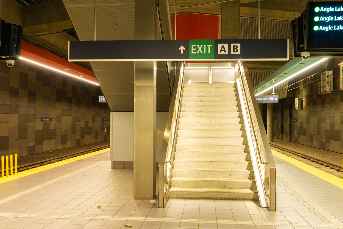
Existing exit sign on platform.
Directional signage on platform directing disembarking passengers to the exits.
Directional signage on showing available exits.
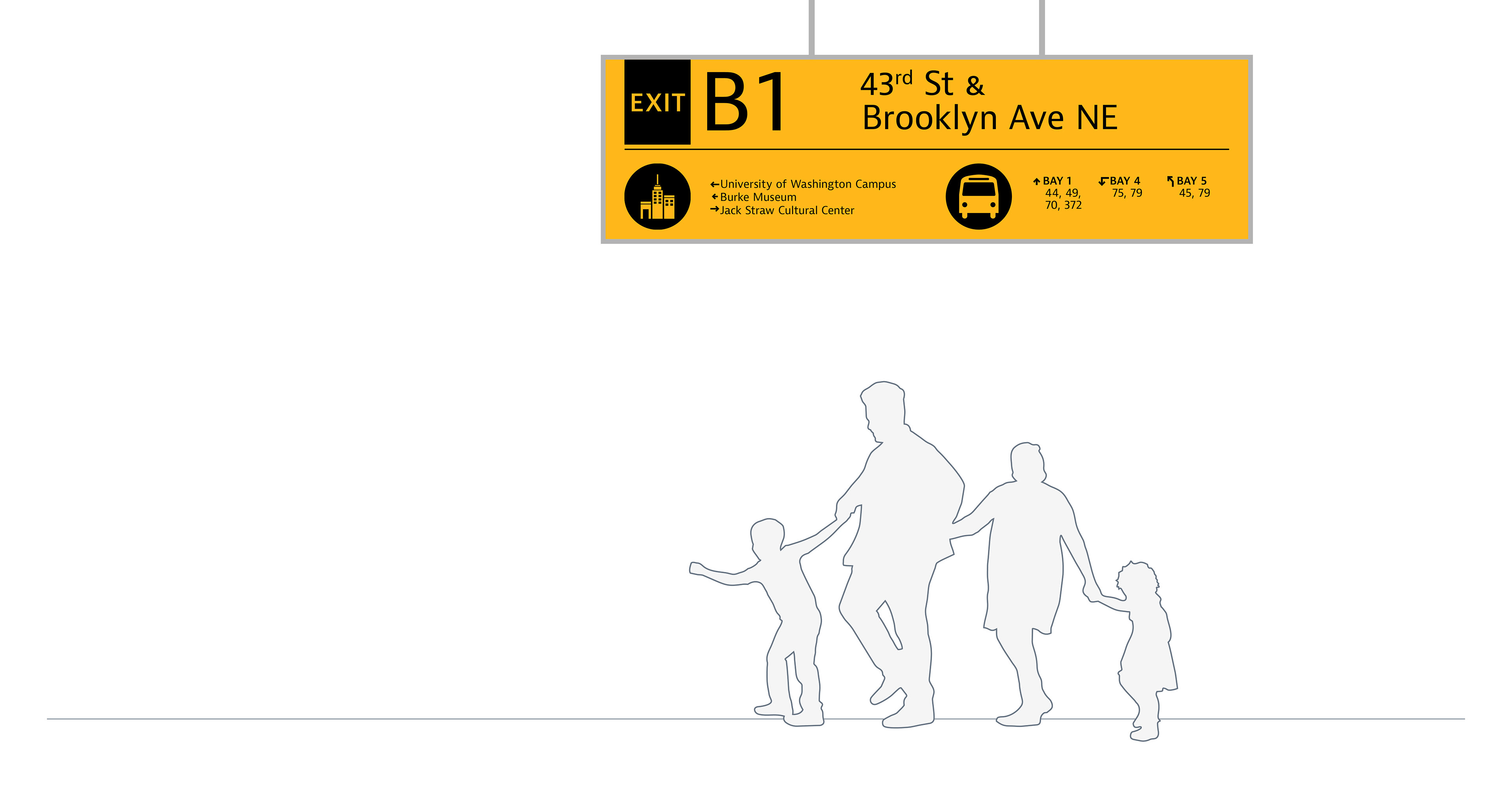
Identification sign at station exit, including details for inteded destination.

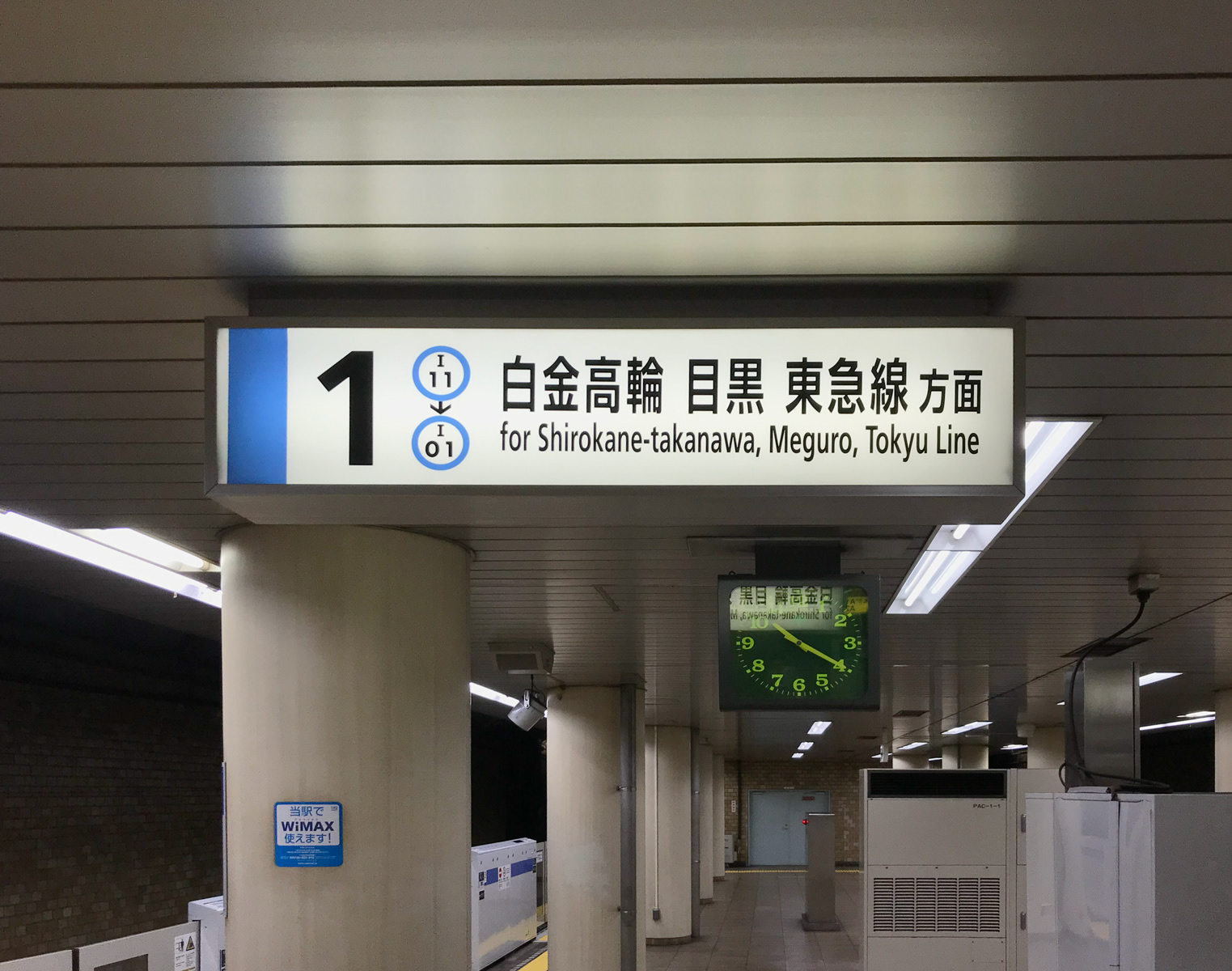
Tokyo Metro overhead identification signage designating line and direction served by platform.
Existing identification signage as you descend to platform.
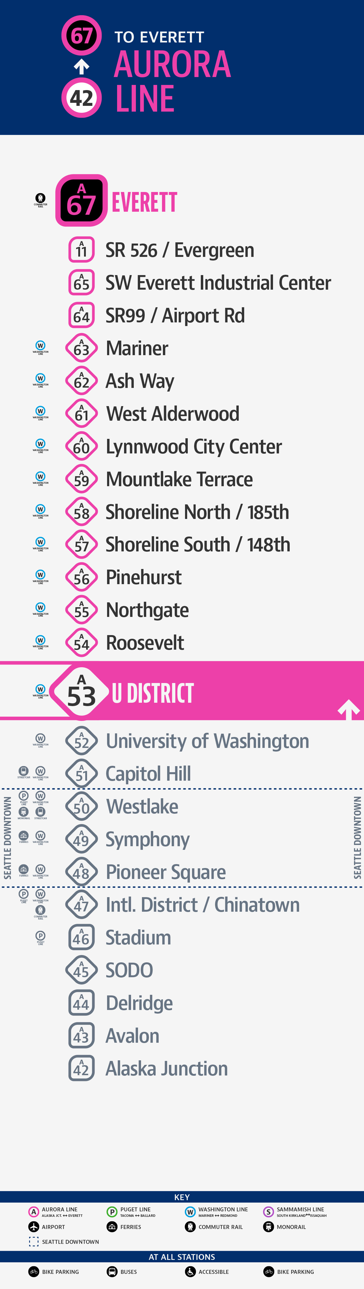
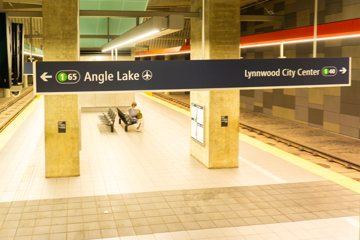
Providing the current station number alongside the line terminal helps riders quickly identify ascending or descending lines.
Station identification sign on left is promimently visible to passengers on rail car when train arrives.